The High Atlas Mountains: Morocco's Other Landscape
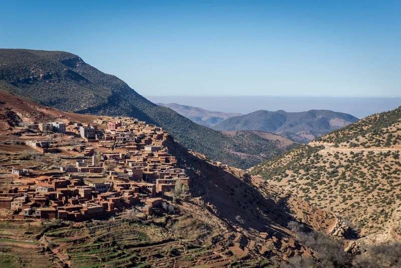
When travelers imagine Morocco, they picture imperial cities and rolling sand dunes. The High Atlas rarely appear in that picture, which is an oversight. These mountains run 700 kilometers across Morocco's center, with peaks exceeding 4,000 meters. Toubkal, North Africa's highest summit, rises to 4,167 meters about 65 kilometers south of Marrakech.
From Marrakech's city center, you can be on alpine terrain in under an hour. That proximity changes how you might structure a trip, because the Atlas does not need its own allocation of days. It is an extension of Marrakech: close enough for a day trip, substantial enough for a week.
High Atlas At a Glance
Geography That Shapes Experience
The Atlas range divides into three sections: the High Atlas running southwest to northeast through central Morocco, the Middle Atlas in the north, and the Anti-Atlas to the south. For most travelers the High Atlas is the one that counts: the biggest elevation changes, the Berber villages built into hillsides, and enough infrastructure to make walking here straightforward.
The range creates Morocco's weather patterns. Atlantic moisture hits the mountains, drops as rain or snow on the western slopes, and leaves the eastern side increasingly arid until you reach the Sahara. This explains why Marrakech and the desert, though not far apart in straight-line distance, feel climatically different. The Atlas sits between them, intercepting moisture. Many travelers combine mountain trekking with desert nights for exactly this contrast.
The mountains also preserve a distinct Berber culture. Geography created isolation, and isolation preserved languages, building techniques, and agricultural practices that shifted elsewhere. When you visit Atlas villages, you're seeing architectural solutions developed for specific problems: steep terrain, temperature swings, limited building materials, and the need to defend against historical raids.
The Three Roads In
Three main routes connect Marrakech to the High Atlas. The road to Imlil heads south through Tahanaout and Asni, climbing steadily to 1,740 meters where the road ends and mules take over. This is the gateway to Toubkal trekking. Drive time is 90 minutes from central Marrakech.
The Ourika Valley road runs east and south, following the Ourika River through increasingly narrow gorges. The valley gets crowded on weekends with Marrakchi families escaping city heat. Monday through Thursday sees fewer visitors. You reach the valley entrance in 45 minutes, though most continue another 30 minutes to Setti Fatma where hiking trails begin.
The Tizi n'Tichka pass crosses the range completely, connecting Marrakech to Ouarzazate and the desert beyond. The road climbs to 2,260 meters, curves through dozens of hairpin turns, and passes Berber villages that seem constructed vertically. This is the route you take when driving to the Sahara. Allow four hours for the 200 kilometers to Ouarzazate, and longer if you stop for photographs or spend part of the climb behind a truck.
Road conditions vary by season and altitude. The paved roads are generally good though narrow, rain creates temporary washouts, and snow above 2,000 meters can close passes between December and March. Mountain seasonality differs from desert and coastal timing. Spring and fall offer ideal conditions while winter snow limits high-altitude access. Local drivers know which routes are clear on the day; take their word for it.
What Mountain Days Include
You can drive through, stop for photographs and be back in Marrakech by dinner, and you will have missed most of it. What the Atlas offers arrives on foot: on the trails, in the village squares, at the pace of people who live at altitude.
Day trips from Marrakech work for valley exploration. The Ourika Valley offers restaurants built over the river, short hikes to waterfalls, and potters working in small workshops. You're back in Marrakech by evening. Imlil works the same way, with longer hiking options if you start early.
Multi-day stays require accommodation in mountain villages. Gites and small hotels exist in Imlil, Ait Benhaddou, and scattered kasbah conversions. These aren't luxury properties by city standards. Rooms are simple, bathrooms straightforward, heating inconsistent. What you get for that is a trailhead five minutes from bed at dawn, when the light comes across the valleys and the paths are empty.
Day Trips vs. Overnight Stays
Day trips work well for Ourika Valley (waterfalls, river restaurants) and basic Imlil exploration. A guesthouse buys you the two hours a day trip never reaches: the trails at first light, and the village square after the last minibus has gone.
If you have 2-3 nights, spend them up here. If not, a well-chosen day trip is still worth doing.
Trekking spans the full range. Valley walks need ordinary fitness. Toubkal needs solid conditioning, cold weather gear, and typically two days with a night at a refuge. No technical climbing is involved, but altitude affects everyone, and most people find the summit push harder than expected because 4,000 meters stresses breathing and pace.
Village construction works with the terrain instead of fighting it. Houses stack up hillsides, each roof serving as another's terrace. Irrigation channels carved centuries ago still water the gardens. Weekly souks gather in specific villages, where farmers trade produce and families handle the year's big purchases. They are working markets rather than attractions, and visitors are welcome to walk through.
Imlil, Ourika, Ait Benhaddou, Ouzoud
Imlil functions as the main Toubkal base. The village sits at the roadhead where paved surface ends. Mules and hikers continue up. Accommodation ranges from basic gites to one proper boutique property with heated rooms and good food. The village itself takes ten minutes to walk through. The trails around it are the reason to stay.
From Imlil, several day walks are possible without going high enough for altitude to matter. Aroumd, written Armed on some maps, is 40 minutes up the valley through walnut groves and terraced gardens, its houses stacked in a block on the shelf above the riverbed; it is the highest village in the Ait Mizane valley, and most walkers carry on past it toward the shoulder where Toubkal comes into view. Tamatert sits east of Imlil at 1,810 meters, on the track that climbs toward the pass that shares its name, past irrigation channels and shepherds moving flocks between pastures with the season. Carrying on above the village to the col is a half-day walk. For a market you go the other way and downhill: Asni holds the valley's weekly souk on Saturday morning. We run a private walking day above Imlil on exactly this ground, leaving early enough to finish the climbing before the sun clears the ridge.
Ourika Valley gets mentioned often because it's close and the waterfalls are easy to see. The lower valley has been thoroughly developed, restaurants and guesthouses along the road; past Setti Fatma it gets quieter. The hike to the seven waterfalls is popular, but the climb spreads people out. The trail is steady, sometimes steep, with somewhere to stop at each waterfall level.
The valley provides comfortable hiking without the commitment of overnight treks. You can judge conditions, turn back if weather changes, and be in Marrakech for dinner. This makes it suitable for families and less experienced hikers. Our Ourika day leaves Marrakech early enough to reach the upper valley before the coaches, and brings you back down for a late lunch.
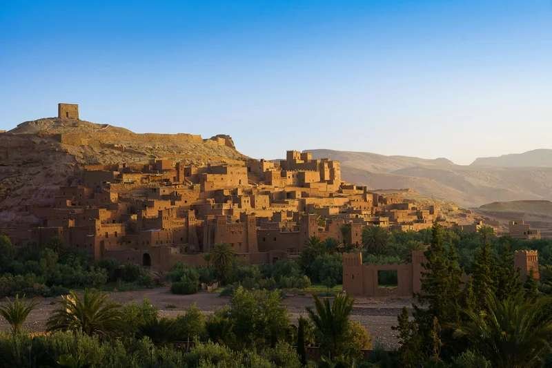
Ait Benhaddou technically sits in the pre-Saharan zone beyond the High Atlas, but most visitors reach it by crossing the Tizi n'Tichka pass. The fortified village is UNESCO-recognized and heavily photographed, and film crews still use it regularly.
Nearly a hundred families lived inside the walls in the 1940s. Fewer than a dozen remain today, the rest having moved to the newer village across the river, where the water and the electricity are reliable.
The site is worth visiting despite tourist presence. The mud-brick architecture demonstrates defensive design adapted to earthquake zones. Towers buttress walls, rooms interlock for stability, and the whole structure follows the contours of the hill it sits on. Go early morning before tour groups arrive, or late afternoon when most have left.
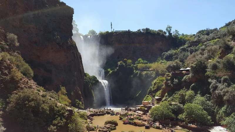
Ouzoud Waterfalls lie northeast of Marrakech in Middle Atlas territory but get grouped with High Atlas visits. The falls drop 110 meters in three tiers. Barbary macaques inhabit the area, approaching visitors who appear to have food. The monkeys are wild but habituated to humans. Don't feed them, despite locals encouraging it.
The water runs year-round here, unlike many seasonal waterfalls. Several trails lead to different viewing points, and the walk behind the falls gets you wet from the spray. Restaurants line the canyon rim and the quality varies; the best of them are at the parking area end.
When Seasons Matter
Spring brings snowmelt and wildflowers. From March through May the mountains turn green and the rivers run full. Trails above 2,500 meters shed their snow cover and stay muddy for weeks afterwards. At mid-elevation (1,500-2,000 meters), days run 12-22°C and nights drop to 5-10°C.
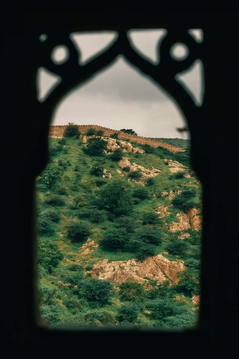
The wildflower display peaks in April. Slopes bloom with rockrose, lavender, and endemic species that grow nowhere else. If plants are any part of why you travel, April is worth planning the trip around. Photographers prefer the month too, for the green and the cloud.
Why April, Specifically
April lines up more of the variables than any other month: trails open but still green from the snowmelt, wildflowers at their peak, comfortable temperatures, and fewer people than high summer.
Book accommodation 3-4 weeks ahead for April stays. This is when Moroccan families also visit, and mountain guesthouses are small.
Summer heat makes the lower elevations uncomfortable and opens the high trails. June through August, Marrakech reaches 38-42°C, while at 2,000 meters the days stay around 25-28°C and the mornings are cool enough for a jacket.
Moroccan families know this. The villages fill up in July and August, and the guesthouses book out fastest at weekends.
Summer is the high-trekking season. July and August give the Toubkal ascent its most settled weather and least rain, though snow can hold in north-facing gullies into June, and thunderstorms build over the ridges in the afternoon with very little warning. Summit parties leave before dawn to be off the top and heading down by midday.
Fall mirrors spring conditions, with October offering particularly stable weather. September can still feel like summer in the valleys. November brings the first snow to peaks above 3,500 meters. Fall colors appear in valley deciduous trees in late October, though the Atlas doesn't produce the dramatic autumn displays found in temperate forests.
From December through February snow sits on the peaks and the upper slopes, and there is skiing at Oukaïmeden, 80 kilometers from Marrakech and the highest resort in Africa at just over 3,200 meters. It runs when the snow allows, which in a thin winter means a few weeks, and the lifts and rental shops are basic next to European or North American areas. Morocco's other ski areas are small and open erratically; the most developed of them is Michlifen, near Ifrane in the Middle Atlas, a long way north and serving Fes and Meknes.
Winter Equipment Requirements
Winter hiking requires proper equipment. Trails at lower elevations (below 2,000 meters) remain accessible but can be muddy and cold. Night temperatures drop below freezing at any mountain elevation.
Villages that seem charming in summer reveal their heating limitations in winter. Wood stoves provide warmth where they exist. If visiting December-February, bring layers, waterproof boots, and realistic expectations about guesthouse heating.
Who Benefits From Mountain Time
Active travelers get the most obvious return. If you hike, climb or ride, the terrain runs from gentle valley walks to technical ascents, and the infrastructure supports all of it without expedition-level logistics.
Families with children old enough for sustained walking (typically 8-10 years and up) can handle valley trails and village visits. The terrain challenges kids physically while showing them how a village at altitude feeds itself. Younger children may find the hiking tedious and altitude tiring.
Photographers get scale and changing light. Morning fog fills the valleys, burns off mid-morning and leaves the ridges in layers. Late afternoon, the sun comes across them sideways.
Food enthusiasts discover mountain cuisine that differs from lowland cooking. Berber households prepare meals based on what grows at altitude: walnuts, almonds, olives, barley, root vegetables. Tajines incorporate mountain herbs. Hospitality runs on tea and bread straight from the oven. Some guesthouses offer cooking instruction focused on Berber techniques.
The Atlas does not work for everyone. On a first week in Morocco, with the desert and the coast also on the list, the mountains are the easiest thing to cut. And if you want city-standard rooms with heating you can rely on, or if walking any distance is difficult, most of what is up here stays on the other side of the windscreen.
Incorporating Mountains Into Larger Itineraries
The simplest Atlas addition is a day trip from Marrakech. Ourika Valley works well for this: morning departure, lunch by the river, afternoon hike, return by evening. This doesn't require changing accommodation or adjusting your main itinerary.
Two or three nights suits anyone who wants more than a day without giving a week to trekking. Stay in Imlil or a converted kasbah, walk at a different level each day, and see what a village is like once the day visitors have gone.
Multi-day treks require different planning. The standard Toubkal circuit needs three to four days, though fit hikers can compress to two. Other circuits exist: Azzaden Valley, Ait Bouguemez, and longer traverses linking valleys. These need advance arrangement for mules, guides (required in some areas), and refuge or tent accommodation.
The Atlas also works as the transition between Marrakech and the Sahara. Break the drive with a night in Ait Benhaddou or the Dades Valley: two shorter days instead of one long one, and you watch the landscape shift from mountain to pre-desert on the way.
Some itineraries run as a loop: Marrakech, south through the Atlas to the desert, then back along the coast via Essaouira. No backtracking, and four distinct regions in one line: city, mountain, desert, coast, with Essaouira at the end as the recovery day.
Practical Matters Travelers Should Know
Getting around the mountains means a private vehicle or a shared grand taxi. The grands taxis run the Marrakech-Asni and Asni-Imlil legs and go when they are full, which is fine on a day with no shape to it and awkward on a day with one. Most visitors take a private driver, arranged through the guesthouse or the company that built the trip, and what that buys is the ability to stop where you want and move the day around when the weather does.
Transportation Strategy
Private drivers cost more than shared taxis but provide critical flexibility for mountain exploration. Drivers know which roads are clear after rain, where to stop for photographs, and can adjust timing if you want longer or shorter hikes.
Book drivers through your accommodation or a reputable company. Avoid arranging rides with random offers in Marrakech. Quality and reliability vary significantly.
Accommodation needs advance booking during peak seasons (April-May, October, July-August). Mountain guesthouses are small, often 6-12 rooms. They fill quickly when weather is good. Book at least two weeks ahead for these periods. Shoulder season allows more spontaneity.
How Small the Inventory Is
Mountain accommodations don't have the inventory of city hotels. A popular guesthouse in Imlil might have 8 rooms total. During April or October, all 8 rooms could book out 3-4 weeks in advance.
If you have fixed dates during peak season, book mountain stays first, then build the rest of your itinerary around them.
Guides are optional on the valley paths, where the trails are marked and any shepherd will point you back to the right one. They are not optional on Toubkal: the park has required a licensed local guide for the summit since 2018, and the paperwork is checked on the way up. On the quieter routes between valleys, take one anyway, because they know which passes are still holding snow and which houses will give you lunch.
Mobile phone coverage exists in major villages and valleys but disappears on trails and in remote areas. Don't rely on navigation apps. Carry paper maps or downloaded offline maps. Tell your guesthouse where you're hiking and when you expect to be back.
Springs, streams and village fountains supply water throughout the populated valleys. Higher and more remote than that, you carry your own. Most mountain water is clean, but tablets or a filter weigh nothing.
Making Mountain Decisions
The case for the mountains is straightforward. You walk, the landscape changes under you during the day, and you get to see how a village at altitude feeds and heats itself.
The mountains also provide temperature relief. If your trip falls in summer, Atlas time offers respite from lowland heat. Even one night at altitude makes a noticeable difference.
Consider the mountains when planning Marrakech time. Three or four nights in the city allows a day trip to Ourika without feeling rushed. A week-long Marrakech stay easily incorporates two or three nights in Imlil.
The Atlas shifts a trip from pure cultural tourism toward something with weather in it. It suits people who get restless after three days of cities and markets and would rather walk than sit in a car, and who want to see how Morocco's diverse terrain creates its regional differences from the ground.
You will meet Moroccan families on weekend outings and trekkers with a week to spend, but nothing like the density of the Marrakech medina or a desert camp in high season. The villages run for their residents; tourism is a supplement, not the economy.
You can see the High Atlas from the rooftops of Marrakech. It is Morocco's other landscape: an hour from the city, and still the part of the country most itineraries leave out.
Quick High Atlas Reference
One Thing Worth Getting Right
A morning walk through the terraced gardens will teach you more about mountain Morocco than racing up Toubkal for a summit photograph. Walk slowly, sit in the village squares, and watch the light move across the valleys. Most people who come for the summit see less of the valley than someone who stayed two nights and never went above 2,000 meters.
Planning mountain time in Morocco? Altitude, terrain and season go into the plan at the start, not once the hotels are chosen. We put mountain lodges into honeymoon experiences, pick hikes children will finish for family adventures, build cultural immersion around village days above Imlil, and run culinary experiences in kitchens where the bread goes into a clay oven. Tell us what you're looking for.
Frequently Asked Questions
- What is the best time to visit the High Atlas Mountains in Morocco?
April and May offer the best combination of accessible trails, wildflowers in bloom, comfortable temperatures, and fewer crowds. September and October provide equally stable weather with pleasant conditions. Summer opens high-altitude trails but valleys get hot, while winter brings snow above 2,000 meters and can close mountain passes.
- How difficult is hiking in the Atlas Mountains?
It depends entirely on what you choose. Valley walks in Ourika, or between the villages above Imlil, need ordinary fitness and shoes with some grip. The summit of Toubkal at 4,167 meters is a different undertaking: solid conditioning, cold weather gear, and normally two days with a night at the mountain refuge. Nothing on the standard route is technical. Altitude is the part that catches people, and since 2018 the park has required summit parties to take a licensed local guide, checked at a control post on the way up.
- How far are the Atlas Mountains from Marrakech?
Closer than people expect: the Ourika Valley entrance is about 45 minutes from central Marrakech and Imlil, the main base for Toubkal trekking, roughly 90 minutes. Either one works as a day out from a Marrakech hotel.
- Can you visit Berber villages in the Atlas Mountains?
Yes. Several sit within a walk of Imlil: Aroumd, written Armed on some maps, is about 40 minutes up the valley, and Tamatert lies east at 1,810 meters, on the track that climbs toward the pass that shares its name. These are working villages, with houses built into the hillside, terraced fields, and irrigation channels that have been running for centuries. The valley's weekly market is at Asni, below Imlil, on Saturday morning, and visitors are welcome to walk through it.
- What is the altitude of Toubkal in Morocco?
Jebel Toubkal is North Africa's highest peak at 4,167 meters, located about 65 kilometers south of Marrakech. The standard ascent typically requires two days with an overnight stay at a mountain refuge. Technical climbing skills are not necessary, but the altitude stresses breathing and pace, and proper conditioning is essential.